
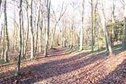
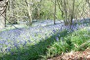
We provide a number of ways to help you find the meeting points for our walks. In the following we use Kithurst Hill on the South Downs as an example meeting point.

If you enter your postcode in the field below Finding our walks and click/touch Set Postcode, then for each walk there will be a link saying Directions from “postcode” where postcode is the postcode you entered. The directions are provided by Google maps. You can vary the suggested route by dragging it onto other roads. Even if you don’t need directions, this service can be useful to see how long the journey will take. It will also show where there’s heavy traffic and other incidents that may affect your journey (best to check just before you start out).

![]() what3words Click on the what3words link and the what3words website should open with a map showing the walk start point. If the link does not work for you, copy the three words to right of the link, then open the website https://what3words.com and copy the three words into its search box and you should then see the start point.
what3words Click on the what3words link and the what3words website should open with a map showing the walk start point. If the link does not work for you, copy the three words to right of the link, then open the website https://what3words.com and copy the three words into its search box and you should then see the start point.
View map shows the start point of the walk at the centre of your chosen map, just click on the link given for the Google Maps page. The location given when using this link is more precise than the 6-figure grid references given for the walks.

Google Maps will give you a satellite view and also show bus stops. Google Maps provide Street View in most areas (drag the ‘yellow man’, which you see near the top-left corner of the map, to the road you want to see), so you can see what the approach to the car park will look like when you get there. In Street View you can move along the road and rotate the view.
If you use satellite navigation in your car you may be able to use the lat/long coordinates given for your destination. If you do this, please note that the lat/long will often indicate a point which is not on a public road, so care may be needed on the final stages of your journey. The link to Google Maps uses exactly the same lat/long as the one provided for the walk and hence provides confirmation of precisely where this is.
Please be aware that Sussex Pathfinders cannot be held responsible for the accuracy of information provided by external websites.